 | ||||||
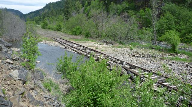
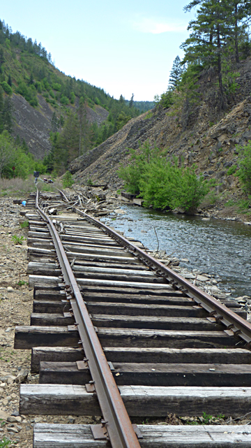
The above two photos were taken in about the same spot. The lower photo is looking toward Jaype
and the original washout is about a 1/4 mile out of sight on the left. The top photo is looking toward Orofino. The water next to the track is the new stream channel, and below on the right the original.
We were beginning to doubt that any further work had been done. As we reached the washout at MP 14 we had to stop about 1/4 mile short of where the washout had been in 2008. The stream had completely taken out the railroad embankment. It had formed a new channel and was now flowing down both sides of the tracks.
The railroad is now isolated on a peninsula ending where the stream divides. The new channel backs up to a vertical rock cliff and during high water flowed over the roadbed and ran back down the hill to rejoin the original stream. It subsequently channeled out several locations under the tracks. The stream level was only moderate when we were there, but was still flowing in the new channel.
The extent of damage and the need to restore the stream to its' original channel will be a massive undertaking. Because it will mean major work to the stream it may require environmental approval. The cost may not justify the projected logging income. My personal feeling is that it will be several years before the line is reopened, if ever.
Story and Photos - Peter
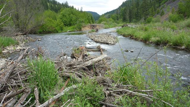
Looking toward Jaype. The rail line can barely be seen in the upper center. The stream originally flowed to the
right of the gravel bar. It has now removed a huge section of earth and created a new channel to the left at the top of the photo. This entire area was underwater during flood season and will be again. A long trestle may be the simplest solution.
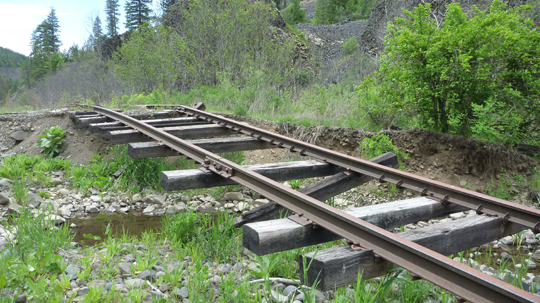
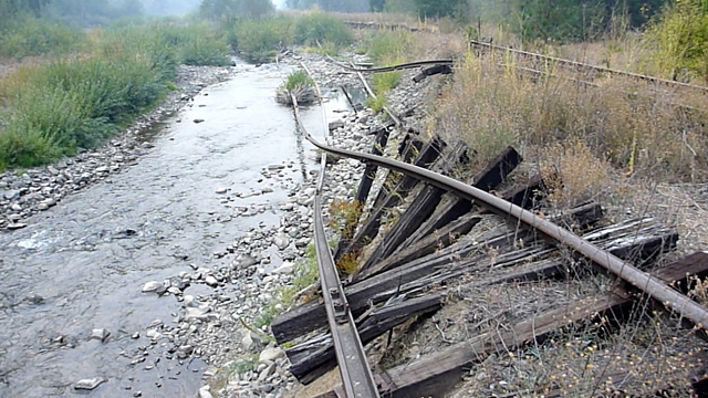
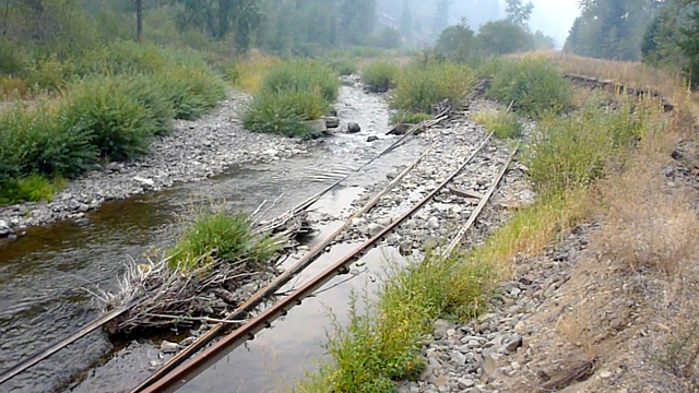
These two photos show
where the new stream channel
flowed over the top of the roadbed
and undermined the rails,
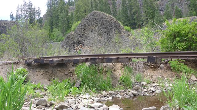
These two photos show the upper
washout at MP 15 as they appeared in 2012.
4th Sub 2013 continued