 | ||||||
| ||||||
The Astoria Line
Formally operated by the Spokane, Portland and Seattle and now under the banner of the Portland and Western, the line to Astoria, the oldest community west of the Mississippi
River, is now a railbiking opportunity.
No freight revenue, a failed tourist endeavor, and a major washout have closed the western portion of this scenic line which hugs the banks of the Columbia River and runs along the sloughs and marshes at Oregon's most northern border.
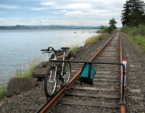
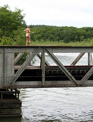
On the section between Wauna and the old Brownsmead
Station, the rails run adjacent to the Columbia River. the
mountains in the background are in Washington state.
by Peter Hoffman
| ||||||
John Vander Ven, his friend Bill and I met in Astoria on a recent Saturday morning to scout out the line for before Arne and Morgan arrive in September for the big Fall tour.
John and Bill's wives drove to the set-on point with us and shortly after we took off we got a cell phone call from them warning us that there was an open swing bridge just a quarter of a mile down the line. A local security guard, not with the railroad, had stopped to chat with them and told them of the open bridge.
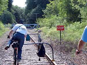
Sure enough, we soon came on
a sign warning us to stop, for just
ahead the rails ended in mid-air.
We walked out on the bridge as
far as we could to get a good look
at the crossing. As luck would have it, Bill dropped his cell phone off the edge of the bridge. Miraculously the phone landed on a piling about two feet above the water. With no way to get down to it, John called his wife and asked the ladies to drive back into Astoria to buy a fishing line and a big hook for Bill thought he could snag the phone and pull it to safety.
| ||||||
Right, John heads the "STOP" warning and begins his dismount. A moment later, Bill's cell phone went over the edge of the bridge approach.
Top left, the same bridge as seen from the opposite side later in the afternoon. Four local teenagers were swimming to the bridge and using it as a diving platform.
| ||||||
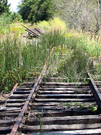
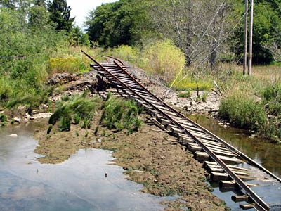
Knowing the cell phone recovery was going to take an hour or more, I decided to head up the road and find a new place to put-on on the other side of the open bridge. I found a spot about half
way between the ends of the section we were scouting. I started to ride back towards the open
bridge, but thought I saw a high-rider on the tracks ahead, so I turned and road in the opposite
direction. Just after reaching the point where we had expected to end our survey the rails came
to and end in the gravel ahead of me. The embankment seemed to continue on, but no ties or
rails. I was most perplexed. After a moment of searching the area, I saw the rails with the ties
attached resting up against a stand of River Birch trees about 100 feet from the right-of-way.
| ||||||
| ||||||
| ||||||
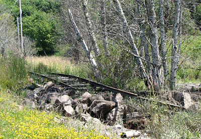
Perhaps 100 yards of rail and ties were swept one hundred feet off the roadbed. If you look close in the photo above, just to the left center, you can see another rail. Both the main line and the siding were washed away and stacked one on top the other.
Crossing the washout would be a monumental task, requiring disassembling my bike and making at least two trips across a small stream with water at least knee deep. And combined treck of about four lengths of a football field. I decided to turn around and head back. And a good thing too, for we later learned there was another open turn-bridge abouta half mile ahead. The effort in crossing would have been totally wasted and repeated on the return trip.