Northwest Tour 2010
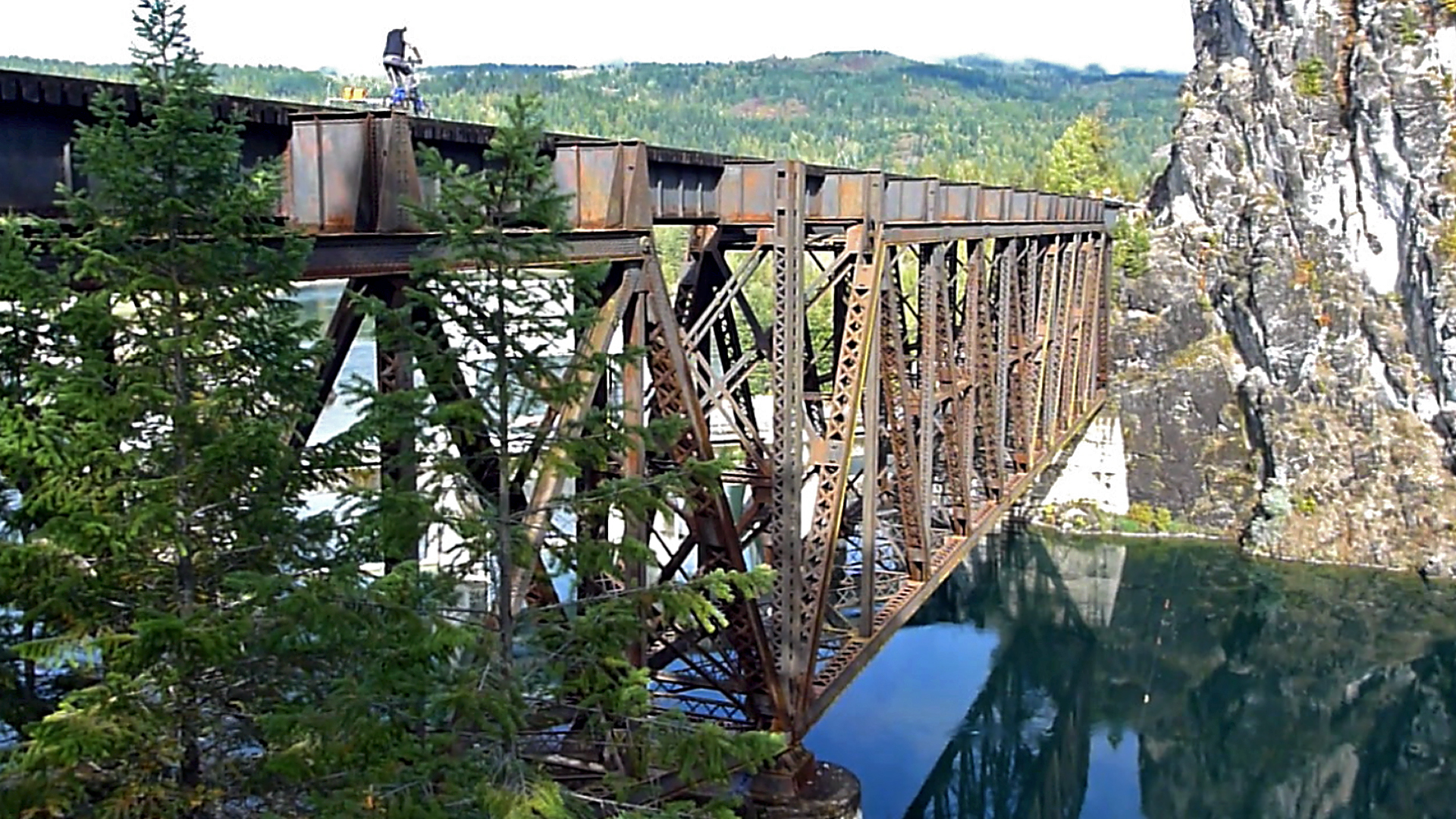
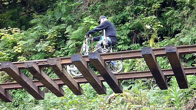
Arne crosses the spectacular bridge over the Box Canyon Dam and powerplant on the Pend Orielle Valley RR.
    The 2010 tour was unique in that there were new railroads to ride for everyone.  Among the newcomers were  the Coos Bay Line, the rails over Siskiyou Summit, The Port of Tillamook Bay RR and the Pend Oirelle Valley RR.   We railbiked in four states, California, Oregon, Washington and Idaho over a period of 13 days.


    Below are photo albums for each segment representing a few memories of each.  Click on the first picture in the album to enter.  Then use the "Previous" and "Next" arrows at the top to scan the  photos.
The Coos Bay Line
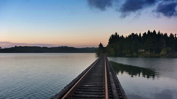
The Coos Bay line traverses a multi-varied landscape, from the agricultural farmlands of the Willamette Valley to the forested heights of the Pacific Coast Range.  It winds along river canyons.  It follows the shore of multiple inland coastal lakes crossing time and again on long trestles.  Finally it ends by paralleling the Pacific Ocean through high dunes of white sand.
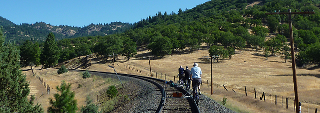
The old Southern Pacific line over Siskiyou Summit spanning the California-Oregon border was not in use but still being maintained.  We climbed both the south and north sides to the summit tunnel and coasted back to our starting points. The Oak covered foothills and golden grass are typical of California and southern Oregon.
Over Siskiyou Summit
North of Hilt we begin  the 8 mile, 3% climb to the summit. In the background is Toshi Choling, said to be the largest Buddest temple outside Asia.Ken and Jim take a break on the relentless 3% grade. 14,179 foot Mt Shasta is in the background.The group heads down the southern slope into California.
Pilot Rock is in the background.Crossing under the historic Pacific Highway bridge at Steinman.  The bridge is as it was almost 100 years ago (see historic photo album).Arne approches tunnel 14.  which negotiates a tight horseshoe curve and is unimaginably dark (see historic photo album).Morgan heads into tunnel 14.  Dick's flashing red tail light can be seen ahead.  Halway through in the pitch black Ken's bike came off the track.
We spent several  moments with flashlights getting the bike running safely again.Crossing the busy Interstate Highway 5 we tried to keep a low profile to remain undetected.  There were only a few spots on the ride where we could be seen from roadways.Peter descends across the Wall Creek Viaduct, the only trestle still remaining (see historic photo album). High on the mountainside, try to imagine what a great view greeted passengers in the early years  befoe the trees had grown.The current peek-a-boo view from the Wall Creek Viaduct.  In the early days, the railroad could be seen on three levels below as it snaked up the mountains, and you could see for miles in both directions.Tunnel 13 at the summit is 3108 feet long as was the site of the last great train robbery in the western U.S.  Three trainmen were murded during the 1923 holdup. The tunnel was completely gunited in 2004 after a major fire closed it for two years.Ken is seen through the windows of one of the very dilapadated maintenance buildings that remain at Siskiyou at the summit of the pass.  At one time there was a station and a turntable for the helper engines.The traditional after the ride elbow-bender.  Here we enjoy the late afternoon at our motel in Canyonville, Oregon, on our way back to Portland.
Morgan crosses one of the many washouts along the Salmonberry River.  The group split up for two days for rest and repairs and Arne, Morgan and Peter spent the time on the Tillamook line.
The Tillamook Line
To eliminate redundancy, please click the button above to visit the Tillamook pages.
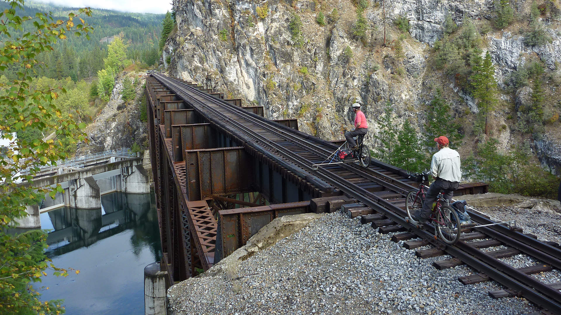
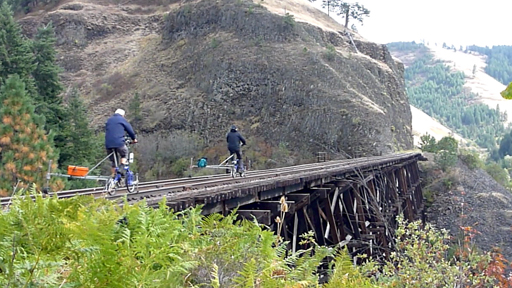
Ken leads Dick across the bridge spanning the Box Canyon Dam.  If you won't admit to being a little squeamish crossing this one you're either a liar or a fool.  The Pend Orielle Valley Railroad graciously gave us permission to ride the line.  The railroad is located in north eastern Washington just below the Canadian border and runs between Ione and Metaline Falls.
Pend Orielle Valley Railroad
We took over the entire motel in the small town of Ione.  Happy hour as usual, while watching the locals drive by.The Boots and Saddle Saloon was the scene of our pool championship.  Don't challenge Ken.A small trestle just outside the town of Ione.  The Pend Orielle Valley RR is now a tourist line.  Ken and his wife, Cindy, attended one of their Board Meetings and got permission for us to ride.  There were two tunnels on the line.  This one had a slight curve but as soon as entering you could see the other end.Compare this photos with the two large shots on this page above and you get a good feeling for the Box Canyon bridge.Michael is probably breathing a sigh of relief after safely reaching solid ground.Box Canyon Lake from the high bridge.Yes, too many photos of this bridge, but you don't come across these spectacular crossings often.This natural bore went through a massive outcropping of rock.Showers and sun breaks were the norm for the day, but a little moisture didn't dampen our spirits.The rails end in the picturesque  town of Metaline Falls.  We had lunch in the park before heading back to Ione.
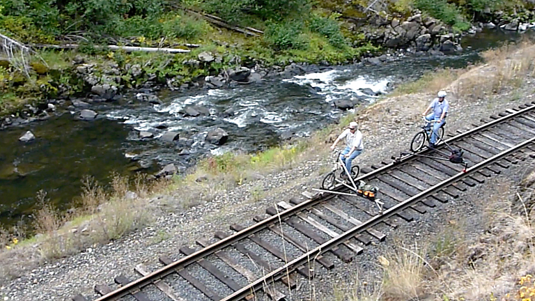
Jim and John cruise along a white water section of the St. Maries River.  The St. Maries River RR is not in use between St. Maries and Bovil, making two days of riding possible.  The group split by accident, and one section rode out of Bovil while others went on to ride the Camas Prairie.
St Maries River Railroad
The lower section of the St. Maries River was still and peaceful with mirrored reflections of the surrounding countryside.John heads out on the first leg of our ride.Dick crosses the St Maries in the lower canyon.  Without a saw, we had to pull this fallen snag off the rails.Ken looks happy but we didn't find any refreshments.Jim heads downgrade across the big steel  bridge in the upper canyon.  This is about the halfway point on the ride and we found it a good place for lunch.Morgan and Arne emerge from one of the two tunnels.  There was a rockfall in the middle which was hard to see until you ran into it.  Michael did some rock moving so the ride home was clear.John is seen in the canyon section where th rock walls form high cliffs.  A variety of geography makes this a great ride.Arne has just popped out of a tunnel and crossed the St Maries on an interesting steel span.Morgan is dwarfed by the rocky cliffs ahead.  A little Autumn color is beginning to show.Two tunnels, several steel bridges, fascinating rock formations and great river views are amoung the high points along the line.Dinner in St Maries after the ride. Dick entertained us with his rendition of an owl he saw on the ride that day.
Cocktails before dinner on the shores of Siltcoos LakeChef Morgan preparing his stuffed avacado specialty.Five star resturants had nothing on our group.The first tunnel south of Ada had electrical cables laying across the rails about halfway through.  It was also partially flooded and the floor was thick with mucky mud.  Jim and Peter had to go in with rubber boots on to clear the track before the group could pass.Morgan leads the way across one of the many long trestles on the several lakes along the route.  The Swedish flag proudly flys on his outrigger.This maintenance vehicle scared the heck out of us when it surprised us on the line.  A railroad employee told us there was to be no activity the day we rode.  So much for advanced information!The Coos Bay Line seems to spend as much time crossing the lakes as it did running along their shores.When not riding along  lakeshores we found ourselves in lushly wooded canyons.The view from Arne's video camera as he crosses a trestle on Tahenitch Lake.Scotch Broom is the bane of many neglected railroads in the west.  Here Arne and Moran battle their way through a long stretch of heavy growth.This day we established a first:  We were stopped by a sheriff's patrol in a boat. They hailed us from the water, but when they determined we were harmless, the let us go our way.Ken and Dick head back to the town of Lakeside along the shores of 10-Mile Lake. Note the long trestle in the backgorund.
Camas Prairie RR

Arne starts the long climb from Culdesac to Rubens with dark clouds threatening. The rain held off until we left the Half Moon on the way back down the canyon.Arne and Morgan take a break on the climb.  Although it was later to rain it was near 70 degrees.Peter on the Half Moon (I had to get my photo in here somewhere just to prove I was on the tour).  Is the Half Moon getting bigger or am I just getting older?Arne takes his turn.  Who could ever get tired of seeing photos of the Half Moon?   Wives don't count.Near the top of the grade the view off the trestles to the bottom of the canyon is breathtaking.The view from Arne's video camera.  Rock slides were found at the entrance to 
all the tunnels.On the top of the prairie  the weather was glorious.  As a native of Cottonwood, Jim always feels like he's home again.Ken crosses the high trestle just east of the Lawyers Canyon bridge.  The rails end a hundred feet past the trestle.It was here Morgan broke  out in song, "Oklahoma, where the wind comes sweepin' down the plain, And the wavin' wheat, can sure smell sweet,  When the wind comes right behind the rain - - -." The roadbed in this shot looks almost like the old Nez Perse Railroad, which once joined the Camas Prairie RR not far from here.Trestles on a prairie, who would have guessed? Even though the rails have been pulled up from Grangeville  past Ferdinand, the best of the railroad remains.Our final group dinner at the Indian casino just outside of Lewiston before everyone headed home.
This trestle was on the south side of the summit and was filled in the late 1800's.  Note the unusual construction  at the bottom where the slanted pilings meet their vertical counterparts.Three locomotive struggle upgrade with seven cars across the sinuous Dollarhide trestle which was filled in 1917.  Finding it's location today is difficult as the fill on both sides is heavily forested.The Pacific Highway, still in its infancy, took an equally circuitous path over the mountains, making a loop before crossing itself and the railline at Steinman. The photo of Arne was taken at a spot about 100 feet behind the locomotives.One of the more spectacular engineering feats in the Siskiyous,  is the loop at milpost 415.  The track, dropping down the grade, enters tunnel No. 14 and makes a 14-degree turn upon itself, comming close enough to the lower level to require a short tunnel (No. 15) below.  Now obscured by trees.The Shasta Limited emerges from the summit tunnel at Siskiyou in a cloud of smoke.  From here, the trains wound down the mountainside on their descent to Ashland.The west portal of the summit tunnel was the scene of the last "Great Train Robbery" on October 11, 1923.  A major fire in the tunnel in 2003 burned the creosote-soaked timbers which collapsed.  The line was reopened in 2005.  For a robbery account:  www.tunnel13.com/history.robbery.html On the Wall Creek Viaduct, passengers were treated to breathtaking vistas of the  vallely below.  The original wood trestle was replaced by steel in 1902.Doubleheaded ten-wheelers work hard as they lift train N. 15 up the Siskiyou grade in 1912.  Crossing the Wall Creek Viaduct the train has just traversed the track visible down the hillside to the right.
Interstate Hwy 5 now runs just above the tracks below.I took this shot after railbiking down to the viaduct from the summit and waiting for the southbound morning train, then followed it back to the summit.
I could hear it laboring up the grade for a half hour before it reached Wall Creek.  Recommended:  Rails in the Shadow of Mt. Shasta by John Sigmor
Because of the heavy forest growth, riding the Siskiyou line today does not give justice to its engineering and rugged mountain beauty.  The album below has some historical photos to compare with those above.
Arne and Morgan head up Lapwai Canyon from Culdesac.  Our group split on this day, some riding the St Maries RR near Bovil and others riding the Camas Prairie.  The following day we all rode the prairie together from Craigmont across the Lawyers Canyon bridge to the end of the rails..
Return to Nutshell